Regional models

We build high resolution regional wave and 3D ocean-circulation models which provide hyper-local ocean forecasts in nearshore regions where it matters most. These are the same models we develop for studies, but are run on a daily operational schedule with redundancy built in for reliable delivery. The forecasts form the basis of downstream applications such as the planning of operational windows, turbidity forecasts for coastal intakes, oil spill tracking, and search and rescue.

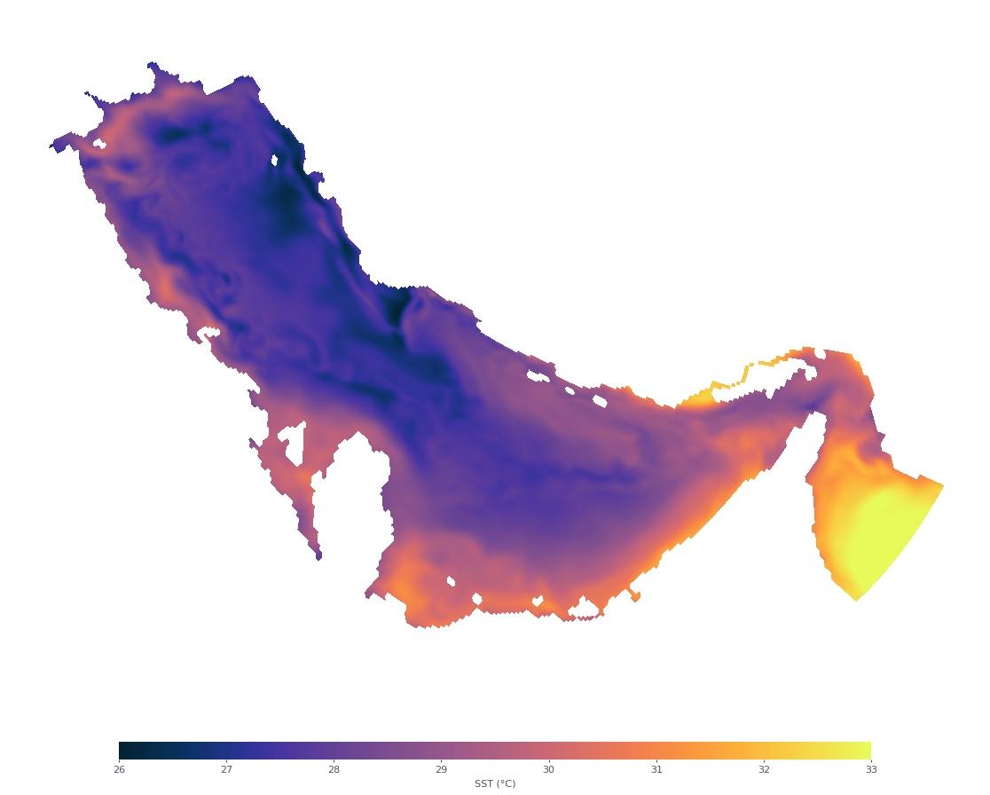
Sea surface temperature snapshot from an example regional forecast domain
Model Regional ocean — example domain Field Sea surface temperature Time loading… Cycle Operational · 7-day · updated daily
Variables forecast over this domain

Shaping model outputs into decisions

The regional model is only the starting point. We shape its output into a product built around the decision being made — the right variables, at the right location, on a bespoke dashboard designed around the question the client is asking. Where possible, forecasts carry confidence bands that reflect the underlying uncertainty, so decisions can be made with a clear sense of how much to trust the outlook.

Example 01

Port operations

Who this is for
Port operators planning vessel access and berth allocation, where low-water and/or high wave events take an entrance channel or berth out of service.
What the client cares about
Whether each planned operation can take place under the prevailing and forecast environmental conditions.
What we build
A site-specific water level and wave forecast at the berth and/or entrance channel, updated daily. Total water level and the non-tidal residual are forecast separately, while confidence bands tell the operator how much trust to put in it.

Example 02

Coastal intakes

Who this is for
Any operation drawing seawater from a coastal intake — desalination plants, power-station cooling water, land-based aquaculture (RAS), coastal industrial intakes.
What the client cares about
Intake water quality, screen and filter management, pre-treatment planning, protecting downstream processes from sediment, salinity, and temperature events.
What we build
A site-specific water quality forecast at the intake — temperature, salinity, and turbidity, daily, with per-variable alert thresholds set by the operator.

Learning the local error

A physics-based model captures the dynamics, but at any given site it still carries systematic error — a persistent bias, a timing offset, a local effect the grid doesn't resolve. Where a site has a solid record of in-situ measurements, that error tends to be predictable, and predictable error can be corrected.

So where the data supports it, we train a machine-learning correction on top of the physics forecast — it learns the residual between what the model predicts and what the instrument has recorded, and applies it to each new cycle. It doesn't replace the model; it sharpens it at the location the client cares about most. The precondition is observations: without a sufficient record at the site, there's nothing to train on, and the physics forecast stands on its own.

Tell us what you're deciding — we'll tell you how we'd forecast it.

info@oceanmotionanalytics.com →